Planned destination 1: Mt. Sherman, Mt. Dyer, Mt. Gemini (from Iowa Gulch)
Planned destination 2: Mt. Silverheels (from Hoosier Pass)
Companion: Jeffrey
We didn't pull into Silverthorne until about 1:30 AM, and needless to say, we overslept the alarm. On our way out the door around 9:00 AM this morning, we decided that it would make for a more enjoyable day spent leisurely hiking than to make a mad summit dash at Mt. Sherman. Thus, we decided to go up "Mt. Silverheels, the characteristic mountain visible from Breckenridge, via Hoosier Pass." Normally, Jeff has brilliantly accurate, intimate knowledge of Summit County mountains, so we went with the notion that we were starting out toward Mt. Silverheels.
 |
| The trailhead is visible immediately east of the Hoosier Pass rest area. |
 |
| My compatriot for the day. This man is too epic for his own good. |
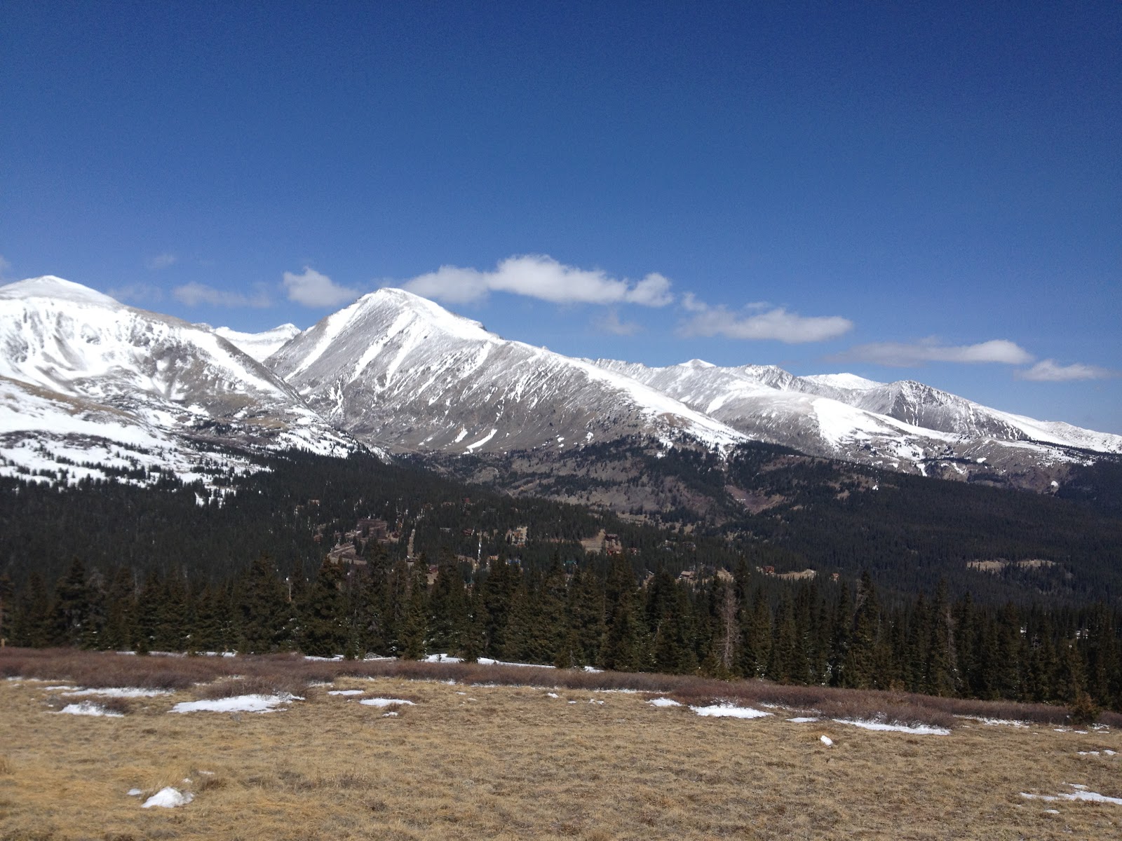
After about 15 minutes of hiking along the continental divide, we were above tree-line. The views of the Mosquito and Tenmile ranges were staggering. There was much rejoicing as we realized this would be our playground for the morning.
 |
| Mt. Lincoln (center) and Mt. Cameron (left) looking sexy. |
 |
| Good times. |
There was no shelter to speak of, as 85% of the day's hike was through the alpine tundra. Oddly enough, the worst winds we experienced happened at the lower elevations, and once we got up to around 13,000' the air was perfectly calm.
 |
| We thought that this ridge connected and went left to Mt. Silverheels. |
 |
| Definitely not Mt. Silverheels. I believe that the more (ahem) correct appellation is Red Peak (left). |
 |
| Quandary Peak, also looking sexy. |
We muddled forth into the abyss. The sun was out, and although at times there appeared to be some clouds forming over the mountains to the west, we enjoyed clear skies all day.
Once we crested the first part of the ridge, a behemoth appeared across a short valley to the south of us. "Dude, that looks sweet! Think of all the lines you could ski on that thing! I wonder what its called?" We were in awe, and simply could not understand why we hadn't heard of this peak before.
 |
| The beautiful, unknown peak (~13,800')... strange, isn't that what Mt. Silverheels' elevation is? |
 |
| On the continental divide, with our day's work ahead of us. |
We continued to walk along the divide that simultaneously straddles Park and Summit Counties as well as Atlantic and Pacific oceans, and headed north following the ridge crest. The series of gentle slopes, gradually gaining elevation, made for a fantastic day in the mountains. It was a beautiful day to be hiking.
Due to time constraints, we decided to stop for lunch at Pt. 13,240', about a half mile and 100' vertical of hiking short of the ridge high point. The resulting views were simply fabulous.
 |
| A look back at our ascent route. |
 |
| Looking south and east into the lower Montgomery Gulch. Pikes Peak is just visible left of center in the photo. You can clearly see it from the top but alas my camera resolution couldn't handle it. |
 |
| Mt. Silverheels; we will return to visit soon. |
Round trip summary:
Time: 4 hrs
Distance: 7.5-8 Miles
Elevation Gain: ~2000'


No comments:
Post a Comment