Friday, June 29, 2012

Climbing, Camping and Reading: The Finer Things in Life

Since this is supposed to be a journal of my outdoor exploits, I suppose I should record the latest and greatest adventures. I started working at EXPAND since going up Mt. Evans in June. This, combined with the recent Waldo Canyon fire, has unfortunately detracted from my happy-being-outside-time. Granted, I do get paid to ride the water slides at Boulder's many pools with fourth-graders, its not quite the philosophical mindspring that I usually dedicate my summers to indulge from. A couple of afternoon climbing sessions and a single night camping at Left Hand Reservoir have been my only outings.

Part I: The highlights

Climbing with Nathaniel at North Table Mountain
- Bro-ing out in the sunshine
- First-ever lead climb. We took turns reaching various bolts along the way, and may or may not have zigzagged up three adjacent routes to reach our anchor, but we did it. Moral of that story is that lead climbing is intensely terrifying. It is a terror that I've come to more or less expect while climbing class V pitches but for some reason simply cannot get used to. I am consistently caught by surprise with how out of control I feel while hanging thirty feet above terra firma. The omnipresent voice that whispers soothingly, "I can't do it," is only matched by the rush and sense of self-reliance (not to mention a huge amount of trust in the belayer... its a great incentive to keep dinner conversations cordial when entertaining in-laws. I'd hate to be perilously hanging atop a crag only to hear a mischievous voice call up, "So tell me again exactly how badly my climbing shoes smell?" For the record, and any future reference, they smell of spring lilies and butterflies frolicking hand-in-hand in abundant sunshine) that prevails once the objective is achieved.
- Note to self - multiple Del Taco gut bombs prior to climbing should henceforth be considered a poor choice and avoided whenever possible.

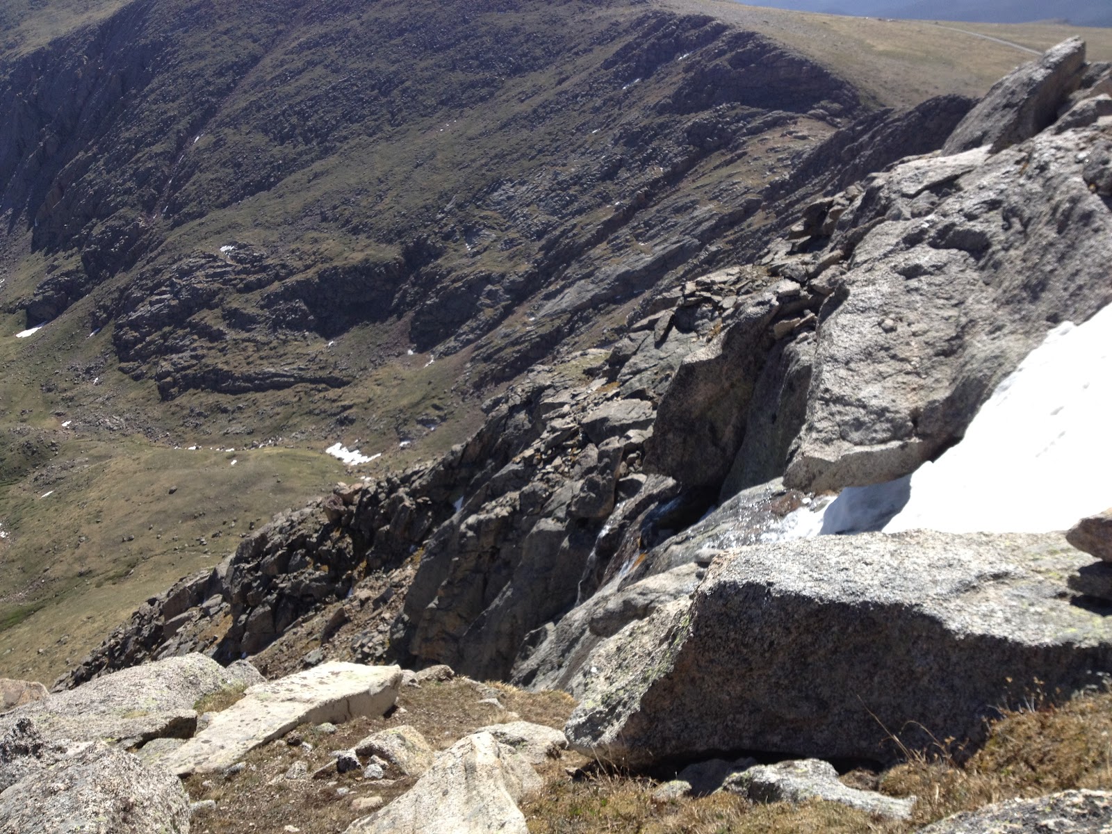
Camping at LHR and bouldering at Mt. Sanitas with Gigi, David and Tiffany
- New sleeping bag, fresh from the REI garage sale (60% off) fits me perfectly and is much like laying in a cloud of coziness.
- This was the first time that my lovely hammock has come camping. Hammock overlooking the reservoir + badass sleeping bag + starlit sky = an orgy of good outdoorsy vibrations.
- Speaking of hammocks and outdoorsy vibrations, I had the opportunity to spend an hour or so with Gigi reclining in our hammocks near the entrance to the access road while we waited for our companions to join us. In my opinion, some of the most attractive traits that another human being can possess are the ability to sit calmly and contentedly among trees, literacy (bonus points for utilizing this skill for leisure, and further bonus points for not reading intellectual black hole material like dieting books, Sean Hannity/Bill O'Reily, or this blog), and if they are not someone who also enjoys hiking/biking/skiing/running/jumping/climbing trees, then someone who understands and accepts the impulse for another human being do so. I feel privileged and elated that my partner is a sexy beast that possesses all of those qualities and more.
- Bouldering was hot! Tiffid was good company for the excursion, however, and we celebrated a successful afternoon's adventure by taking a swim. I love fantastic afternoons spent with fantastic people.

The author and Gigi, enjoying a game of rummy. 

Dave enjoying some hammock love.

Awesome campsite.

Part II: Meditations

The Deck
I had the privilege to sit on my deck and smoke a cigar the afternoon after bouldering with Tiffid. Anyone who has ever candidly philosophized with me at any length has heard of the fabled deck at my parents' home. Although I've recently identified as a non-theist in many respects, there are certain locales that I hold in the esteem of Holy Places. Things so-called "decks" live in my mind among the fine company that comprises the centerpiece of the Holy Table at which my soul dines. As I sat in the comfortable shade of the deck at my current residence, my mind took a walk among the pines and my sense of Self washed over my thoughts.
Summer is the time in which I recharge; there is room to think and grow, to try new things and to lay things to rest. During the school year there is time only for academia but in the summer there is time to pause. I realized (only last weekend?!) that I hadn't yet returned to this annual pilgrimage. Sitting on my deck in the evening shade - after a weekend of camping and climbing - I sat alone with myself in the knowledge that I am Home. It is a beautiful thing, and a gift that I only know how to give or receive when in proximity to the calm that is life out of doors. Summer has begun.


On The Loose
Since reading M. John Fayhee's Bottoms Up early this spring, I've wanted to track down a copy of and read On The Loose by Terry and Renny Russel. It is a book that chronicles the two brothers' collected philosophies and photographs of their travels into the backcountry leading up to 1966. I found it devoid of the angst-riddled prose that I would have expected to come from brothers 19- and 21-years old at the time of writing. All I ever wrote about at their age was how angsty my angst was; these were pages compiled by persons of intensely considerable humanity. When I read On The Loose, it jived with my youthful impulse to go run/climb/hike/bike/experience every mountain and valley that ever existed. I haven't been out as much as I would have liked to recently, but its all good because I know that adventure is out there waiting to be found.
In reflection of their time spent together and out in the wilderness, I am left with this quote from page 83:

"Well,
Have we guys learned our lesson?
You bet we have.
Have we learned to eschew irresponsible outdoorsmanship, to ask advice, to take care and plan      fastidiously and to stay on the trail and to camp only in designated campgrounds and to inquire locally and take enough clothes and keep off the grass?
You bet we haven't.
Unfastidious outdoorsmanship is the best kind.

Adventure is not in the guidebook and Beauty is not on the map.

Seek and ye shall find."


Sunday, June 10, 2012

The Long Way to Mt. Evans

I returned to the Mount Evans Wilderness area this morning via Guanella Pass. I had been to the area three times last year (once in calendar winter) with intentions of hiking Mt. Bierstadt, the Sawtooth and Mt. Evans in tandem. However, all three of these trips ended with singular summits of Mt. Bierstadt.

While planning for this hike during a cribbage marathon with Gigi last night, I made plans to hike the trio in reverse - I would brave the infamous willows first thing in the morning on the way to Mt. Evans, and then traverse the Sawtooth on my way to Mt. Bierstadt and head back to the car along the well-maintained Bierstadt trail. I had reservations about the itinerary for two reasons: this would be my first solo ascent of a 14er, and I did not want to wade knee-deep in wetland for the two-mile approach to the Evans-Spaulding Gully. Especially the latter of the two.

I consider myself a scientist, but sometimes my powers of observation are totally unaccounted for. This morning marks the second time in the last few months that I've walked within twenty feet of a moose and had no idea. (Curiously enough, both encounters happened within twenty feet of each other on the Bierstadt Trail...)
This big guy sent his casual salutations at the top of the morning. He was just as adorable as he was massive. 
Jim Davies, on 14ers.com, provided an excellent verbal map for me to circumnavigate the willows and the class 3 gully.


"Take the Bierstadt trail to just past the big lake (before the creek crossing), turn left and climb over the little hill, continue north through a potentially soggy low section, go over another hill, turn left (back toward the pass) to circle 100 feet or so back around the end of another soggy section, and you'll find the beginning of a dry trail that will lead you up to the Grey Wolf/Spaulding drainage (not the gully)."

After snapping photos of the moose, I made it my business to put as much public land between us posthaste. Over the hill and around the bend brought me to what appeared to be a game trail that had been visited by few hominid footsteps. This was the only opening in the neighborhood, so I went with what I had. If I got wet, then I really wouldn't have lost anything in trying because the other way is much like a 1970's era San Francisco mud bath filled with alpine water-born parasites. 

The trail. The dip on the horizon is the aforementioned drainage. Although taken from different locations, the mountain ridge on the right side of this photo is directly next to the ridge on the left side of the following photo. 
 Unbeknownst to me at the time, but knownst to me now, this seemingly ideal route up to the alpine ridge ends abruptly in a dramatic collection of huge (read: 300ish feet) cliffs at approximately the end of our field of vision in the previous photo. What's more is that Mt. Spaulding (13, 842' - the peak directly to the right of the drainage) backs up its massive toosh right to the edge of said cliffs. The only way to get from drainage to the other side of Spaulding is, as I learned, to summit Mt. Spaulding on the way! I acknowledge that I would have saved a whole heck of a lot of drama if I had looked at a map before I tried to take a new route in unknown territory, but I'm young and I enjoy surprises most of the time.

I will now direct the reader's attention to the fact that Mount Evans lives approximately two miles south and east of The Sawtooth. My attempted shortcut to go around the Evans gully and Mt. Spaulding turned into a three hour, three mile detour wherein I had to summit Mt. Spaulding in the process.

The Sawtooth (13,600') and Mt. Bierstadt (14,060'). Can you guess which one is which?

This is a picture of a mountain (on the left) that I don't know its name but want to snowboard down the left ridge into the center bowl. Every time I come to this wilderness area I spend some amount of time picking out the beastliest line.

A pond in the middle of the willows visible from my first breakfast break. There is water literally everywhere down there.

More water and looking up the main slope of Mt. Bierstadt.
Dry boots! On this point, my guide spoke truth.
 Leaving the spot of breakfast, all cairn specimen ceased to appear. I was led to believe that I should just continue along my merry way between Grey Wolf Peak and Mt. Spaulding. The drainage had some tasteful waterfalls all along the way up. I did not photograph them. You should visit and check it out.

I would now like to add another piece to this pie of torment - the wind. The weather report called for maximum gusts of 25mph, but this was a false statement. It was as though mother nature had had a rough night of binge drinking and poor fraternization choices and was pissed off at whatever weather person claimed to "understand her". At any point above 13,000', the wind held at (my not exaggerating estimate) a cozy 60mph with gusts of I-don't-even-know-how-high. What I do know is that I was rapidly approaching a bank of where-the-sidewalk-ends-type cliffs with unreasonable and unpredictable winds.

These are the little ones. Photo taken from half a mile away.

I later learned that these are called the Chicago Lakes.
 Here's where I had second breakfast and reevaluated my life choices.

Note the slope and presence of ice and snow.
 My only option was to throw caution to the wind and go straight up the side of Mt. Spaulding. It was so blustery that, even while hunkered down in a shelter, I couldn't get my phone to take a picture of the top. There were lots of big-sized rocks surrounded by grassy soil.

I felt that maybe I should just call it a day, since this one wasn't panning out the way I had hoped. On my way down the front side of the mountain, mother nature threw me a curve ball and there was a relative calm over the area. I thought, "surely this nonsense has passed and I can enjoy the rest of my day in the high country sans physical harassment from the air." I was mistaken, but did not find out just how poorly I had chosen until I was halfway along the ridge towards Mt. Evans.

Until today, I had never had a fall on a mountain. Today, I had three. Until today, I had never thought "I'm going to summit and get the eff off this mountain" and then grumpily go about it. Today, I did this. Until today, I had never felt physically sick with emotion and exhaustion while climbing a mountain. Today, I wanted to throw up all over Mt. Evans' face. I was not a happy hiker.

I gained the summit, avoided eye contact with the tourists who drove to the top, ate a cracker and was gone. The wind was so bad that I felt disoriented at times, as though I was being hit in the head repeatedly. The two mile slog back down the spine of the ridge was like walking an inebriated straight line down a talus-filled sidewalk. The Sawtooth and Mt. Bierstadt would have to wait, because I was not going to deal with this wind any more.

Summit view. Note the size of the cliffs over the Chicago Lakes!

The destroyed DU observatory seen from my hiding place in the rocks.

Summit view looking south. The southern Sawatch peaks can just be glimpsed on the right. I was just pointing my camera as I walked at this point.

Summit marker (14,264')

A really bad photo that is included to give a better perspective of the observatory's roof. (ripped open/off)
I left as quietly and sickly as I came and marched the six miles back to my car along the front side of Mt. Spaulding as fast as my legs and pounding head would take me.*

* I would like to note that, while my verbiage is somewhat bitter this evening, it was a beautiful day to be alive and in the mountains. It totally beats sitting at a desk job all day.

Wednesday, June 6, 2012

Gregory Canyon Run

Boulder Open Space and Mountain Parks may as well be a sibling of mine - the entire area resides near and dear to my heart. The only other place that sends me more good vibrations is Ute Valley Park in Colorado Springs (the city does have one or two good things going for it). In particular, area of the mountain parks accessible from the Gregory Canyon Trailhead jives with me the most.

After a CPR/First Aid class this morning, I got the afternoon off. Its been awhile since I've gotten into the mountains for any sensible kind of activity, so I jumped on the opportunity to get a trail run in. At first, my plan was to access the Saddle Rock Trail from Gregory Canyon TH. This would have followed the route I took when I ran up Green Mountain to raise money for KIPP Colorado classrooms last summer. Instead, I did not veer left up Green but continued straight up the canyon with the intention of topping out at Realization Point on Flagstaff Mountain.

The south face of Flagstaff Mountain, seen from the top of the Green Mountain amphitheater last year. 
I saw probably six different kinds of butterflies and the wildflowers were out in force at the top of the canyon. One of my summer goals is to run up Green again, and possibly over to Bear Peak / South Boulder Peak. However, I'll probably have to come back to flagstaff to test myself again before I try this.

Approximate Distance: 2.5 Miles
Approximate Elevation Gain: 1000 feet

Thursday, May 31, 2012

Stevens Gulch: Round Two

Upon our return from the desert, and as the endorphins began returning to normal levels, Gigi and I began to dream of mountain oases high in the alpine tundra. Green grass and high tides precluded the plausibility of going sledding in Boulder. Alas, to sled in the veritable spring-summer hedgerow that has become of our backyard would be impossible! Rather, we forged an alliance to head west, once more, and pay homage to the 14ers that be. It was decided - we must attempt to hike Grays and Torreys! The vertigo and disillusionment that was brought upon our shared house was almost too great of a burden to bear when I returned unsuccessfully from my last summit push on these worthy steeds of granite. With my best girl by my side and a backpack adorned with all the finer things that Clif Bars manufacture for mountainside edible deliciousness, we decided on the morning of May 26.

 Ah.... May 26. It was a tremendous day in the history of our relationship because we were both out of bed before 6:00 AM! At the very least of things, we had this ace up our sleeves should the day turn against us. Gigi's great and noble spirit had been roused prior to the time of the sun's quarter journey across the summer sky by the sweet aroma of coffee, knowing full well that she must wake up in order to imbibe this nectar of the gods. It did my heart good to know that in the event of a weekend zombie apocalypse, I would not have to wait until 9:30AM to rouse her and make way to our secret mountain compound. She's a real keeper.

We arrived at the trailhead around 8:00 AM. There was a line of parked cars extending a quarter mile down the access road from the trailhead. I'll be the first to admit that I tend to "forget" to shower when I'm trying to get in touch with nature, but before we opened the windows there was a veritable musk in the air that could put Ron Swanson ill-at-ease. Not to say any names or anything, but if you're reading this and wondering if it was you in the late-model blue Subaru... check yourself. Even the marmots complained of your odor.

However, we made the best of the situation and made a bee-line for the trail. Our goal for the morning would be the highest point on the continental divide through the contiguous US!

The morning alpenglow pressing over the ridge of McClellan Mountain. The smoke blowing in from the New Mexico fires magnified the effect.

The view from the car. It seemed that the whole county had descended upon the trailhead this morning, yet we managed to squeak out a prime parking space. You can see Grays Peak peering over the foot of Kelso Mountain, just left of center. 

Isn't she cute? What an epic mountain woman!
As we ascended into the bluebird sky, we made a game of trying to find the most varied species of flora and fauna along the trail. Gigi obviously beat me at this game. I had forgotten the golden rule: it is never a good idea to challenge a biologist to counting small life forms in an isolated space. We did manage to find a mountain (or is it alpine?) sunflower along the trail, though.

Unfortunately, we did not make it to the summit, and were thwarted by ice and snow at approximately the same elevation that Nathaniel and I were thwarted on May 5. However, we did enjoy a rather lovely nap on the side of the trail - lulled to sleep by the serene sounds of other hiker's footprints. We had officially gained the talus field right before the apron, and sat to watch a group of hikers wrestle with the wind as they tried desperately to pack away their tents at the bottom of Dead Dog Couloir. Winds on the trail (and on a side note, apparently everywhere in the high country this Memorial Day weekend?) were exceedingly harsh. Although were were well prepared for warm or cold weather, our posse was caught off guard by the severity of the wind elements at hand. This only compounded the issue of balance on the icy talus and so we were content to sit idly at 12,500' in a large pile of rocks.

We talked and listened as young lovers do best. I acknowledge the severity of poor form we exhibited, but we threw small rocks at different targets in the talus. It was great fun - some smashed, some jumped, some made it waayy down to the snow field, etc. Last week, when I wanted so badly to throw stuff off the cliff, I held back. I am happy to say that my partner is a far worse influence on me than Nathaniel and Mark were, and it was terrific fun. I am always put at ease to see Gigi smiling while on the side of a mountain with me.

The reader may note a lack of photos from this trip. This is because our camera spontaneously ran out of batteries on the trail. The reader may also note the lack of references to Yeti and pro wrestlers we had to fight off along the way. Although these mountains thwarted my approach a second time, they did so valiantly and well-within the rules of chivalry. I have tried in earnest to report the particulars of this adventure in their clearest and most specific form. We made it back to the car a little after noon and headed down to Silverthorne for some Memorial Day sales, and then up to Breck for a nice end-of-student-teaching vacation in the mountains.

Wednesday, May 23, 2012

Escalante Excursion: Day 4

In spite of the warnings, health training, mountaineering experience and ample reserves of water, we did have a small incident in the group of dehydration then eating snickers and chugging powerade - subsequently inducing a foul smelling, off-putting-colored vomitus (right next to, but in very gentlemanly fashion, not on the car) as we pulled into camp Saturday night. Sunday morning, as the birds sang their sweet songs of good tidings to the well-traveled adventurers, I drank a cup of tea and read poetry from the latest edition of the Mountain Gazette. Nathaniel rose next, and we discussed the day's plans. It went something like this:

Nathaniel: "Do we want to hike through the monument?"
Hunter: "Yes and no. What do you think?"
Nathaniel: "Yes and no. I see value in both."

And through this persuasive and heated exchange, a knowing sense of agreement bestirred the surrounding area. "Hike no more shall we," the birds seemed to say, "drive the road using Mark's parks pass we shall." There's so much to see and explore in the monument that you could make an entire trip out of it (really, this is true of all the places we went), I want to come back and spend a dedicated trip here. For the time being, however, the 23 mile scenic loop along Rim Rock Drive sufficed beautifully. 

We pulled off and explored one of the many rest points. It took all my will power not to find a pile of rocks and see how long they would take to hit the ground if I threw them with varying initial velocities and trajectories. This caused me no small emotional distress, and I elected to pretend like I knew stuff about the local geology to distract myself. My two companions generously huffawed and gaffawed with my rambling, and graciously did not themselves throw any rocks off the side either. It was a great success.


If I were to camp here, I would absolutely make up scenarios in my head about being an outlaw on the run in the wild west, hiding from the powers that be while waiting for the fallout of my latest shenanigans to blow over. And then I would never leave.
Once back in the car, we filled up on gas and aimed the car east on the great road towards Rivendell, or at the very least, Boulder.

Escalante Excursion: Part 3

Day 3:

During the previous evening's heated cribbage match - featuring Nathaniel's throttling of Mark and myself - the group decided that it behooved us to move eastward in hopes of cutting down on Sunday's drive time. This worked out in our favor since both of the potential slot canyon hikes were on the other side of Capitol Reef from us. We packed up camp and made the scenic drive through Hell's Backbone, hell's kitchen and the rest of hell's own homely comforts. We stopped by the national park's visitor center and got a stern you-city-boys-look-like-noobs look from a patronizing park ranger who told us that we might want to stay away from any technical hiking in the canyons. As if to say we couldn't handle it - as if (!) to insinuate that our frail Coloradan constitutions couldn't handle the wild, unmatriculated wilderness that predominates the eastern washes of the national park. However, in the name of safety, we did consider her advice seriously. Then, we decided that with a forecast of clear skies and bromance, fortune favored the bold. We took on the technical route of Cottonwood Wash. It was the right decision.

The path follows a dry creek bed over decaying flagstone for about a mile, narrows some, continues for about a half mile, and then the real fun begins.

The aesthetically pleasing gateway to the slot canyon. We didn't see a single  other vertebrate organism on the whole hike. Solitude prevailed in the best possible way.

The view from the entryway.
For the first bit, the canyon meanders gently in between 20' cliffs.

The first few obstacles we came across were fairly tame. We wondered if we were in the correct wash for a brief moment or two.

"Technical obstacles? That park ranger must have never seen a 14er before!"
And then things started to narrow a bit...


Nathaniel looking cozy.
The canyon began to get deeper and our walkway varied between two and five feet across.
The next three photos were taken from vantage points all within about twenty feet of each other.


Mark and I chimneying to gain passage over a blockade, while passing underneath a giant boulder.

We didn't always go over obstacles. Sometimes we had to go through them.

Mark - looking comfortable.

Mark - looking less comfortable.

Good times.


My critics may scoff at my form, but this was way easier than the way the rest of the team tried to get across.

The farther into the wash we went, the more varied the terrain became. Sometimes the walls of the canyon would be smooth, and sometimes they'd be pocky like a pubescent cheek. In a bizarre twist of irony, one slab actually had little zit-looking lichens growing on it.


This trip made me want to join the Sierra Club, move into a desert cave, hike all day and never  shower again.
The hike came to an abrupt stop after about 3 miles by an "unpassable thirty-foot cliff," according to our online research. We found a wall that was about twelve feet high, scaled it while laughing jovially at the preposterous locals who don't know adventure from summer camp, mountains from molehills, on and on and so forth. "What ludicrous information - this is totally doable!" we told each other. It seemed fine and dandy, and then we looked up... and up... and up - approximately thirty feet of sheer cliff wall to a tiny notch in what for all reasonable estimates was the sky. I immediately ate my words and made a mental note to have my personal assistant send a formal apology to the good people who provide dedicated, reliable information about hikes in the area. The canyon had spoken - the hike in was over.

End of the road. They were right.

There was a lone tree enjoying a monopoly of sunlight and soil in the basin beneath the notch. It was surrounded by a rocky outcropping, destined to be pummeled into sandy oblivion by the desert's forces of erosion. In the mean time, however, Nathaniel "jumped on" the opportunity to take some suggestive photos. 
Nathaniel... expressing himself on a rock.


This was a fantastic way to spend an afternoon. We packed up our bags and broke land-speed records back towards the state line. That evening, we would dine in the greatest state in the union - sweet home, Colorado!

Rabbit Valley is an extension of my very being. We were on the opposite side of the recreation area from the river overlooks but the clear skies and birds chirping was like a call back to reality. I didn't really begin to feel less sick until we set up camp here Saturday night. What a relief to be home and feeling better.

Escalante Excursion: Part 2

Day 2:

Imagine a music dear reader: a lone, serene bassoon perambulating down the sidewalk of a sweet melody. Nathaniel and Hunter slowly rise to greet the soft morning light - the palpitation of Mark's snoring rises and falls in a well-practiced staccato. The mystical desert beckons us to leave the abode of our synthetic shelter with seductive promises of adventure. She's a cruel mistress, she is - so alluring and yet so elusive. Our protagonists must rise and heed her call, lest her promises fall on deaf ears.

Thus, the day began. A weather system was supposed to move through the area during the afternoon, so our efforts must be coordinated accordingly. We enjoyed a delicious breakfast of sauteed onions, mushrooms and scrambled eggs before weighing down the tent with all our worldly possessions to keep it from flying unencumbered into the abyssal canyon below. We expected a small bit of wind and wanted to play it safe; little did we know of the gale that was to come. More on this later.

Packing into the car, we made the quick drive down to the Calf Creek trailhead:


Its hard to see, but the road you drive on to get into the area is along this ridge, and comes from  the Hell's Backbone junction. A 200m elevation change and a little bit of water makes all the difference between paradise and purgatory out here.


The trail wanders up the western side of the canyon, skirting an ancient livestock grazing area that was paramount to the survival of the various native and invasive settlers to the region through the years. One thing that I unfortunately didn't make a visual record of was the brochure that we picked up at the trail register. There were approximately 14 stops along the 2 mile trail that recounted the history, flora and fauna of the area while amicably reminding visitors to drink loads of water. Granaries and cattle fences still stand that were erected long ago, and in the case of the granaries, we were often left with the question of "how did they get to their granary that was 150m off the ground on the side of a sheer sandstone cliff?" Let alone how they did it when they were hungry with low blood sugar. Folks must have been seriously hardcore to make an existence out here, even in the creek drainage.

What's more is, if you forgot where you put your granary, you would never be able to find it again because it is so well hidden! You'd have to build a whole new one way up on the cliff face. It is at this point that I would like to offer my highly uneducated opinion about the origins of the Fremont hieroglyphs from Capitol Reef: those are pictures of the aliens that helped the natives build their ridiculously-well hidden structures. I am prepared to defend my hypothesis by directing any dissenters' attention to the figures' antennae. It seems to me the most logical explanation.

Mark and I pondering questions of life and existence in the desolate, historical badlands of North America.

This is not a granary for two reasons: a) it is not impossibly high up on a cliff, and b) it does not look enough like a rock.
 As we approached the crossing that would lead us to the falls, a cloak of green dominated the landscape. Much like our youthful spirits, life abounded all around us.


We came around the final curve and heard the rushing of a falls. We had our first glimpse through the trees at what appeared a thin falls coming off the side of a cliff.


I grew up in Colorado Springs - the very heart and soul of evangelical capitalism of the universe. It is home to the for-profit mega-churches that will save your soul and condemn everyone you disagree with for a very reasonable price - comparable to buying a swanky toaster oven on a late-night infomercial. Needless to say, it is not the most "reasonable" or "rational" place in the world, but I digress.  On the city's west side, they have something called Seven Falls - it is marketed as something comparable to Niagra west of the Mississippi. They are very proud of their "seven" falls, and in 2005 (last and only time I will ever visit) it cost me over fifty United States dollars to gain admission. I expected a life-changing, spiritual experience - complete with music and dancing bears and fondue.

Here are some fun plugs for what you get in the Springs (credit to their website for photos):
They extort the local native culture for the
benefit of petty profits!
They posit that the falls spontaneously combust
into a raging tapestry of liquid-hot magma!
There were no dancing bears. There was no life-changing experience. There was no cascade of Tom Cruise's witch-magical fire to engulf the land in a spectre of awe. Instead, I no longer had lunch money for the rest of the week and here's what we saw:

If it was free, I might enjoy it. I payed $50-plus, got attacked by mosquitoes and the girl I went with turned out to be institutionally and incurably nuts - so this sucked.

I digress again, because this is a story of the Calf Creek and not of the controversial marketing techniques employed by local Springsians. 

This story has a happy ending, and it is going to end good!

The Calf Creek Recreation area is apparently world-renown. We heard at least three differently recognized foreign languages spoken by camera-wielding tourists, all of whom were just as wowed by the culmination of the hike as we were. It was as though we had stepped into the very metonymy of paradise. Nathaniel did a tremendous job photographing the scenery, but our cameras simply can't justify how awesome this place really is. 


The dark line you see extending from the falls is actually a  natural, hanging garden shaded from the morning sun. The sandy beach gave way into a shallow lagoon; the green Plantae danced a sweet three-way tango with the crisp, blue water and the deep red of the sandstone cliffs.


Mark and I considering how we could ever follow up this hike with something even remotely as cool. (Note: observe how the pristine shade along the beach provides for excellent meditative potential)

Artistic shot of the spray from the falls.
Yours truly. Definitely one of the high points of the trip.

 A group of tourists (spoke German and no English... possibly from Germany?) were resting nearby. One of them was kind enough to snap a group photo of us with the falls. We bid them a fond "Danke schoen," and turned to head back to the car.
Mark, myself and Nathaniel, dwarfed by the falls behind.
Here are some parting shots of the falls for use as your computer desktop background. They speak for themselves.


Upon our return to the car, we found that the weather had indeed rolled in, and that we probably wouldn't want to be out and exposed to the elements all afternoon. We drove a mile west of our campsite along Utah's Highway 12 and backed up the Jeep to the side of a ~10m rock face. I learned a valuable lesson about how awesome it is to own a Jeep here, and I will share it with you now: in the event that there are no rocks or trees to set an anchor to, you can four-wheel your Jeep to the top of the cliff and anchor directly to your vehicle instead. The manifold has a convenient row of carabiner-sized holes, etched into battleship-grade steel, located right behind the bumper! So, with the addition of two quickdraws and a rope, we were in business.

It is my life's great regret that I did not document the level of badness that ensued during the ensuing climb, both from my Jeep as well as from the three of us climbing. We quickly learned that the reason for all of the surrounding sand dunes in the area is because the rock is literally falling apart. Any lateral pressure on any given handhold while climbing meant a 70% chance of the hold disintegrating in your hand. It was a real challenge, and made doubly-so by the fact that everything was covered in a fine layer of dust that mostly eliminated any friction that the climber may normally rely on to, say, stay on the wall. After about four or five routes each (around 3PM), the weather was coming in fully, and the wind was not messing around. During certain memorable gusts on the side of the slab it was difficult to stand and put away gear at the same time. It got cold fast, and we collectively made the executive decision to just throw everything in the car and deal with organization later. The rest of the afternoon was spent beer-drinking (Colorado Native, appropriately enough) in the tent and playing cribbage.

By the time the tsunami of sand and wind had passed through camp, it was nearing dinner time. All of our worldly possessions had been in the tent in order to keep it from blowing away, and yet before we returned to the tent it had migrated five feet over the sand towards the canyon (the bad direction) from the winds. Also, there was the fun fact that, since everything we brought was in the tent to hold it down, everything we brought now had about five pounds of sand in it, regardless of size. In spite of my  sardonic feelings at the time, a quick glance north towards Boulder Peak reported snow in the highlands. We had driven through that area just yesterday and had considered camping in the aspen forests when Calf Creek campground was full. The juxtaposition of 85-90 degree weather in the morning with snowfall and heavy winds in the afternoon would have been unpleasant in a manner reminiscent of the unpleasantries endured by the Duke of Wellington and the Prince of Orange at the hands of Napoleon's armies during the battle of Waterloo. It was clear that providence had cast us a desirable lot in our decision making on this trip, and by golly day two ended good!

We enjoyed more of Josie's campsite fodder, climbed on a sand tower near the campsite that was in a worse state of decay than our climb from earlier that afternoon, and slept the sleep of the avid adventurer encapsulated in the imagination of young children.