I returned to the Mount Evans Wilderness area this morning via Guanella Pass. I had been to the area three times last year (once in calendar winter) with intentions of hiking Mt. Bierstadt, the Sawtooth and Mt. Evans in tandem. However, all three of these trips ended with singular summits of Mt. Bierstadt.
While planning for this hike during a cribbage marathon with Gigi last night, I made plans to hike the trio in reverse - I would brave the infamous willows first thing in the morning on the way to Mt. Evans, and then traverse the Sawtooth on my way to Mt. Bierstadt and head back to the car along the well-maintained Bierstadt trail. I had reservations about the itinerary for two reasons: this would be my first solo ascent of a 14er, and I did not want to wade knee-deep in wetland for the two-mile approach to the Evans-Spaulding Gully. Especially the latter of the two.
I consider myself a scientist, but sometimes my powers of observation are totally unaccounted for. This morning marks the second time in the last few months that I've walked within twenty feet of a moose and had no idea. (Curiously enough, both encounters happened within twenty feet of each other on the Bierstadt Trail...)
 |
| This big guy sent his casual salutations at the top of the morning. He was just as adorable as he was massive. |
Jim Davies, on 14ers.com, provided an excellent verbal map for me to circumnavigate the willows and the class 3 gully.
"Take the Bierstadt trail to just past the big lake (before the creek crossing), turn left and climb over the little hill, continue north through a potentially soggy low section, go over another hill, turn left (back toward the pass) to circle 100 feet or so back around the end of another soggy section, and you'll find the beginning of a dry trail that will lead you up to the Grey Wolf/Spaulding drainage (not the gully)."
After snapping photos of the moose, I made it my business to put as much public land between us posthaste. Over the hill and around the bend brought me to what appeared to be a game trail that had been visited by few hominid footsteps. This was the only opening in the neighborhood, so I went with what I had. If I got wet, then I really wouldn't have lost anything in trying because the other way is much like a 1970's era San Francisco mud bath filled with alpine water-born parasites.
 |
| The trail. The dip on the horizon is the aforementioned drainage. Although taken from different locations, the mountain ridge on the right side of this photo is directly next to the ridge on the left side of the following photo. |
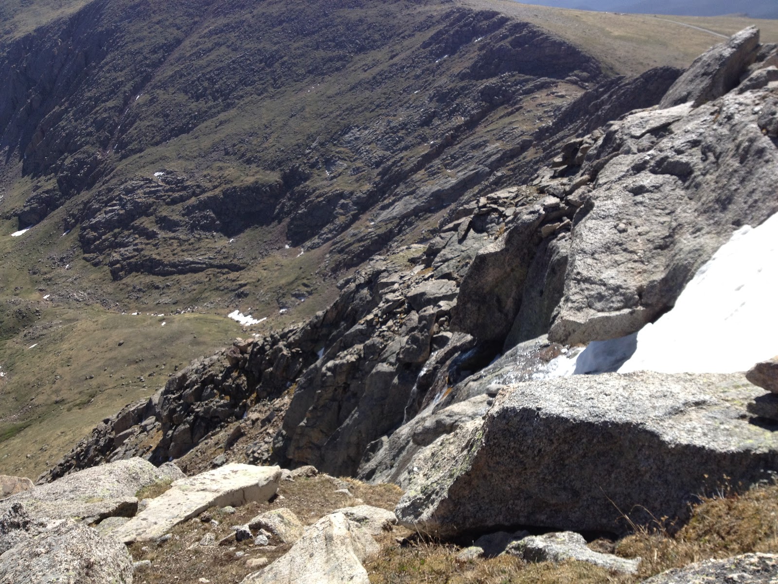
Unbeknownst to me at the time, but knownst to me now, this seemingly ideal route up to the alpine ridge ends abruptly in a dramatic collection of huge (read: 300ish feet) cliffs at approximately the end of our field of vision in the previous photo. What's more is that Mt. Spaulding (13, 842' - the peak directly to the right of the drainage) backs up its massive toosh right to the edge of said cliffs. The only way to get from drainage to the other side of Spaulding is, as I learned, to summit Mt. Spaulding on the way! I acknowledge that I would have saved a whole heck of a lot of drama if I had looked at a map before I tried to take a new route in unknown territory, but I'm young and I enjoy surprises most of the time.
I will now direct the reader's attention to the fact that Mount Evans lives approximately two miles south and east of The Sawtooth. My attempted shortcut to go around the Evans gully and Mt. Spaulding turned into a three hour, three mile detour wherein I had to summit Mt. Spaulding in the process.
 |
| The Sawtooth (13,600') and Mt. Bierstadt (14,060'). Can you guess which one is which? |
 |
| This is a picture of a mountain (on the left) that I don't know its name but want to snowboard down the left ridge into the center bowl. Every time I come to this wilderness area I spend some amount of time picking out the beastliest line. |
 |
| A pond in the middle of the willows visible from my first breakfast break. There is water literally everywhere down there. |
 |
| More water and looking up the main slope of Mt. Bierstadt. |
 |
| Dry boots! On this point, my guide spoke truth. |
Leaving the spot of breakfast, all cairn specimen ceased to appear. I was led to believe that I should just continue along my merry way between Grey Wolf Peak and Mt. Spaulding. The drainage had some tasteful waterfalls all along the way up. I did not photograph them. You should visit and check it out.
I would now like to add another piece to this pie of torment - the wind. The weather report called for maximum gusts of 25mph, but this was a false statement. It was as though mother nature had had a rough night of binge drinking and poor fraternization choices and was pissed off at whatever weather person claimed to "understand her". At any point above 13,000', the wind held at (my not exaggerating estimate) a cozy 60mph with gusts of I-don't-even-know-how-high. What I do know is that I was rapidly approaching a bank of where-the-sidewalk-ends-type cliffs with unreasonable and unpredictable winds.
 |
| These are the little ones. Photo taken from half a mile away. |
 |
| I later learned that these are called the Chicago Lakes. |
Here's where I had second breakfast and reevaluated my life choices.
 |
| Note the slope and presence of ice and snow. |
My only option was to throw caution to the wind and go straight up the side of Mt. Spaulding. It was so blustery that, even while hunkered down in a shelter, I couldn't get my phone to take a picture of the top. There were lots of big-sized rocks surrounded by grassy soil.
I felt that maybe I should just call it a day, since this one wasn't panning out the way I had hoped. On my way down the front side of the mountain, mother nature threw me a curve ball and there was a relative calm over the area. I thought, "surely this nonsense has passed and I can enjoy the rest of my day in the high country sans physical harassment from the air." I was mistaken, but did not find out just how poorly I had chosen until I was halfway along the ridge towards Mt. Evans.
Until today, I had never had a fall on a mountain. Today, I had three. Until today, I had never thought "I'm going to summit and get the eff off this mountain" and then grumpily go about it. Today, I did this. Until today, I had never felt physically sick with emotion and exhaustion while climbing a mountain. Today, I wanted to throw up all over Mt. Evans' face. I was not a happy hiker.
I gained the summit, avoided eye contact with the tourists who drove to the top, ate a cracker and was gone. The wind was so bad that I felt disoriented at times, as though I was being hit in the head repeatedly. The two mile slog back down the spine of the ridge was like walking an inebriated straight line down a talus-filled sidewalk. The Sawtooth and Mt. Bierstadt would have to wait, because I was not going to deal with this wind any more.
 |
| Summit view. Note the size of the cliffs over the Chicago Lakes! |
 |
| The destroyed DU observatory seen from my hiding place in the rocks. |
 |
| Summit view looking south. The southern Sawatch peaks can just be glimpsed on the right. I was just pointing my camera as I walked at this point. |
 |
| Summit marker (14,264') |
 |
| A really bad photo that is included to give a better perspective of the observatory's roof. (ripped open/off) |
I left as quietly and sickly as I came and marched the six miles back to my car along the front side of Mt. Spaulding as fast as my legs and pounding head would take me.*
* I would like to note that, while my verbiage is somewhat bitter this evening, it was a beautiful day to be alive and in the mountains. It totally beats sitting at a desk job all day.